
Bridalveil Falls on the right. 620 feet high, and had lots of water flowing this year.
The following week, three people got swept over a different falls and died.

Looking across Yosemite Valley
at Columbia Rock.
It was about 10:00 am when I signed up, and I was number 24 on the list. Since I had 5 hours, I decided to just cruise around and see what I could see. If I got a spot, I'd stay, and if not, I'd leave. Well, it didn't take long before I confirmed for myself that summer is not the time to come here. The place was overrun with cars and pudgy, loud people wearing Rainforest Cafe t-shirts. Within a few hours I had almost decided that I didn't even want to stay here. With the motorcycle, though, I can always find a place to park, and eventually, the scenic beauty calmed my nerves.

My bike, in front of El Capitan.
I'm really not parked in a handicap zone here. I slipped into a small gap between a parked car (which is now gone) and the blue line. There's always room for motorcycle parking.

At 3:00, I was part of a suprisingly large crowd that had gathered outside the campground office. A ranger came out and said that they had 16 spaces to allocate. I knew that I was number 24 on the list, but there had to be at least 50 people in the crowd. Luckily, enough people infront of me didn't show and I was the next to last person to get a spot for the night. The campground was circus-like, but by now I had already conceeded that, while on family camping trips so many years ago, my brothers and I had surely offended more people than were currently offending me, so it was all OK.

My new tent from REI.
Packs small, and weighs less than 5 lbs.

On the way to Half Dome, you hike by Mirror Lake. I can't remember the name of this formaiton, but it makes up the other side of the valley across from Half Dome. A glacier slid through this valley and carved the sheer face of Half Dome. Think about the Ruth Glacier example above, a mile wide, 3,800 feet thick, 10 miles long, and moving at 3 feet per day - that will scrub out a lot of rock.

Half Dome.
The peak is about 4,800 feet above where I'm standing.

Inspiration Point
This picture is taken from Inspiration Point. El Capitan is on the left, Half Dome is in the middle, and Bridalveil Falls is on the right. In person, it looks absolutely surreal. Unfortunately, from here on out, I've got something on my camera lens.

Half Dome from Glacier Point
This is Half Dome, as seen from Glacier Point. In all my trips to Yosemite, I never made it up here before. But I have to say that this is probably one of the most spectacular views in the World. Glacier Point is directly on top of Curry Village and most of the campgrounds, and there are two ways to get here. Either a challenging 6 to 8-hour hike with 3,200 feet of elevation gain, or a 35-mile drive. The road, however, is closed for 7 months of the year, and there is still snow up here, even in July. The top of Half Dome is at an elevation of 8,800 feet, but some of the peaks on the horizon behind it are over 13,000 feet. You can climb to the top of Half Dome from the back. It's strenuous, but not technicaly challenging. There's a set of cable rails to help you get over the steep hump. I've done it on previous trips, but now you need a permit, and figured that it would be too much of a hassle to try and do it this time. It's obviously slippery when wet, and I read that someone fell about 600 feet to their death just the other day. About 60 people have killed themselves on or around Half Dome.

Curry Village from Glacier Point
The picture above is also from Glacier Point, looking straight down on Curry Village and the some of the surrounding campgrounds. It's a sheer drop of about 3,200 feet. That little circle is actually a parking lot with about 150 cars in it.

Yosemite Falls from Glacier Point
Looking across the valley from Glacier Point to Yosemite Falls. Yosemite Falls is over 2,400 feet high in three stages. It's the highest waterfall in North America, and the 7th highest in the Word. Yosemite has 8 different waterfalls that are over 1,000 feet high (4 of them are over 1,500 ft). There was a huge snowfall this past winter, and the melt has made this one of the best waterfall seasons in years.
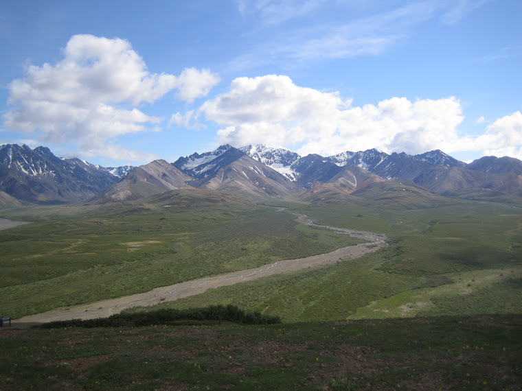
Comparing Denali to Yosemite?
It's apples and oranges. Stunning beauty in both, but different kinds of beauty. Both are vast, but in different dimensions. Denali is hard to get to, so you really have to want to go there. But you'll be rewarded with a feeling that you almost have the place all to yourself. Yosemite is closer and more compact (at least in the popular valley area), but you have to compete with the rest of civilization to see it. They're both awesome though.